

Drone Progress Monitoring
Scheduled drone flights that capture objective, comparable site data and feed measured progress straight into the schedule and earned value.
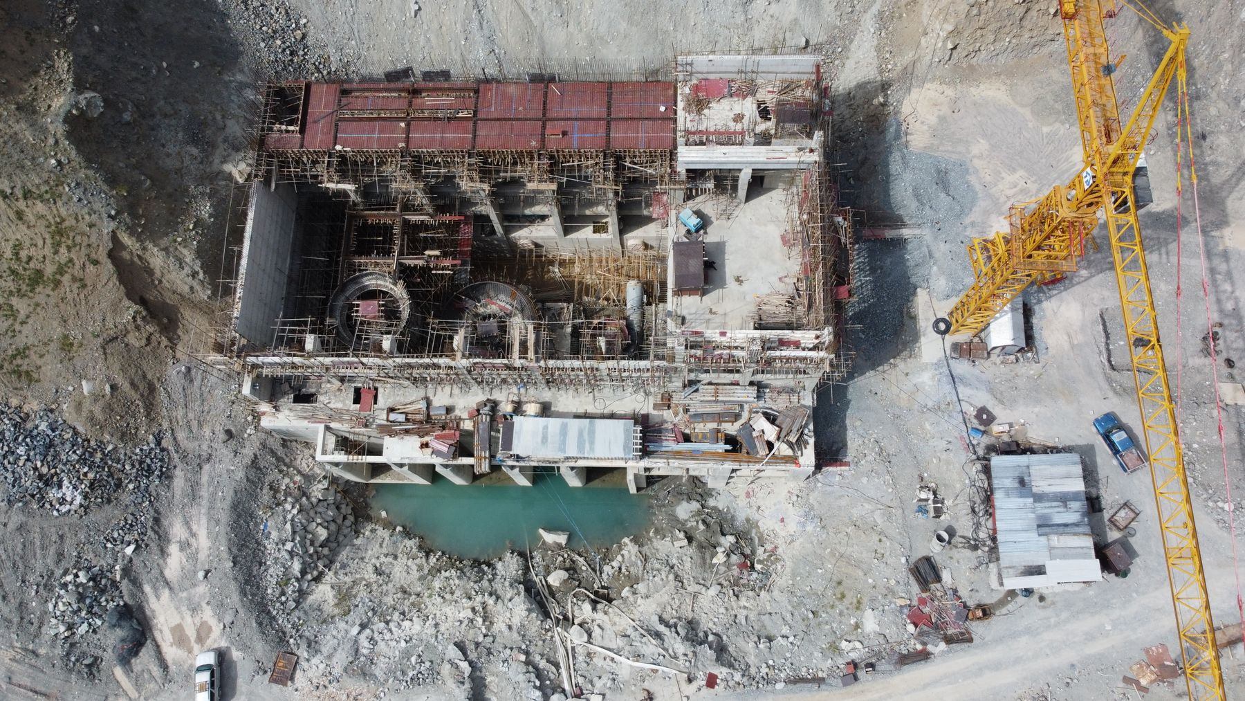
The whole site, measured from above on a fixed rhythm.
Walking a large site to judge progress takes days and produces opinions. A planned drone flight takes about an hour and produces evidence: georeferenced orthomosaics, 3D surfaces and measurements that can be compared with design and with every previous flight.
We run drone programmes built around the controls cycle. Flights are timed to the schedule update, outputs are compared with design surfaces and planned progress, and measured quantities such as earthworks and stockpiles feed progress and earned value directly. Over time the flights build a dated visual record of the project that is invaluable in a dispute.
For linear and large-footprint work, such as highways, rail, pipelines and campus developments, it is the fastest way to know where the job really stands.
What we bring to Drone Progress Monitoring
Senior practitioners, a proven method and the right technology. Every line below is part of the engagement, not an upsell.
Flight programmes
Regular flights aligned with update and reporting cycles.
INCLUDEDOrthomosaics and 3D
High-resolution site maps and surface models.
INCLUDEDVolumetrics
Earthwork and stockpile volumes measured accurately.
INCLUDEDDesign comparison
As-built surfaces compared with design.
INCLUDEDProgress integration
Measured quantities fed into the schedule and earned value.
INCLUDEDVisual record
A dated aerial history supporting records and claims.
INCLUDEDA clear path, milestone by milestone.
A disciplined sequence, so you always know what happens next, who owns it and why it matters.
What you receive
- 01Drone flight programme
- 02Orthomosaics and 3D surface models
- 03Volumetric reports
- 04Design comparison analysis
- 05Progress integration reports
- 06Dated aerial archive
Technology we work in
Platform-fluent and vendor-independent. We work inside your environment, or help you choose the one that fits. We take no reseller commissions.
What changes when we arrive.
Not more reports. Earlier warnings, firmer dates and decisions your board, lenders and teams can trust.
Measurement replaces estimate in the monthly report.
Site-wide status captured in hours, not days.
Dated evidence of every stage of the work.
What leaders ask us first.
Straight answers from the people who do the work. If your question is not here, ask us directly. A senior practitioner will reply.
Are your flights licensed?
Flights are carried out by appropriately certified pilots under the applicable aviation regulations, with airspace authorisation where required. Operator arrangements are confirmed for each engagement.
How often should we fly?
Usually weekly or monthly, set to the schedule update and the pace of work. Earthworks-heavy phases often justify more frequent flights.
Can drones fly safely over a live site?
Yes, with a flight plan, site coordination, exclusion zones and the right authorisations. We agree the procedure with your safety team before the first flight.
How does drone data help in a dispute?
A series of dated, georeferenced captures shows what was built and when, independent of anyone’s recollection. That makes it strong contemporaneous evidence.
Reality Capture & Laser Scanning
Laser scanning, photogrammetry, 360° imaging and aerial capture that document existing conditions, verify installed work and build a defensible visual record.
Construction Analytics
Analytics that join field, capture, schedule and cost data to show where productivity, quality and progress are heading while there is still time to respond.
BIM Integration
Building Information Modelling structured and coded so it feeds scheduling, estimating, coordination and handover, not just design.
See your finish from here.
Tell us where your project stands today. In one conversation with a senior practitioner you will know where it is really heading, what is driving it, and what it will take to land it.
- Senior practitioner on the first call
- Confidential by default
- A straight answer, not a sales pitch